Report: State DOT Using Outdated, Exaggerated Data To Justify Route 17 Widening
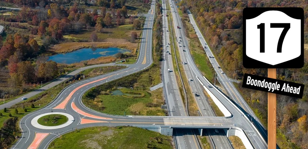
The state Department of Transportation used 15-year-old traffic models to justify its plan to expand Rt. 17 in Orange and Sullivan counties — ignoring a 10-year drop in traffic and overemphasizing a few busy summer weekends, according to a new report.
In fact, the entire premise for the state DOT’s $1.3-billion project, which would add a third lane in each direction to a 31-mile stretch of the road, is based off poorly conceived traffic models that forecast traffic growth despite recent trends, according to report author and traffic modeling expert Norm Marshall. The project’s other justification, Sunday traffic congestion, only occurs on a small handful of weekends, Marshall found.
“The modeling and forecasting that state DOT is using to justify expansion may be seriously flawed in procedural terms,” the report said.
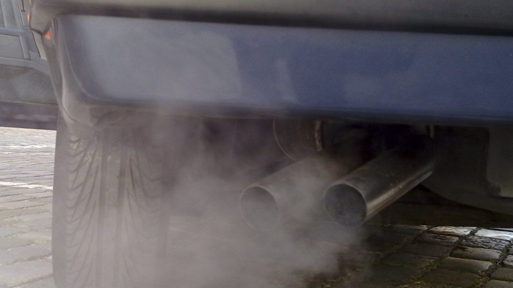
DOT’s own forecasts for the long-in-the-works highway widening predict saving drivers six whole minutes during peak travel times, and only by the far off year of 2050. But induced demand — the process by which drivers fill up new road capacity — ensures that any “congested” time periods or locations will remain as congested as they are today, Marshall said. More traffic will lead to more pollution, undermining the state’s climate goals.
“Research consistently shows that freeway expansion induces additional vehicle travel, and adding one lane in each direction across this corridor is estimated to generate cumulative emissions of up to 2.9 MMT of CO2 through 2050,” Marshall wrote.
Gov. Hochul paused the project last October to give regional stakeholders more time to share their concerns, which is essentially what this report does. But shovels are in the ground on parts of Route 17, laying the groundwork for the expansion. A bridge that carries Route 17 over the Wallkill River just outside of Mechanicstown is already being widened to accommodate three lanes.
Drawing state DOT’s scoping plan for the project and a mash-up of local, state and federal sources, Marshall also argues that state DOT has failed to accurately pinpoint crash hotspots or demonstrate higher-than-average-crash rates, and misleadingly represented speed and traffic congestion in the graphics in its scoping report.
The only regular congestion on the corridor occurs for 15 minutes in the morning and 45 minutes in the evening at Exits 130 and 130A near the Woodbury Commons outlet mall, Marshall found.
“That’s the one place that has got the kinds of problems that they’ve been pointing to, implying that it’s corridor-wide,” said Ramsay Adams, executive director of Catskill Mountainkeeper, which commissioned the report. “The congestion problems are small and targeted in this huge corridor, and it can be fixed, very straightforward.”
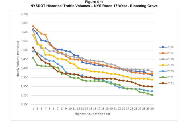
A central pillar of the state’s argument for widening the road is the Orange County Travel Demand Model, which Marshall found to be fundamentally flawed. The model calculates travel behavior using a survey conducted in 2010 and 2011, and therefore doesn’t account for changed driving habits in the last 15 years, including a sharp decline in driving among young people. While the state’s projections are based on the assumption of a traffic boom, the actual 10-year trend for the corridor is down, not up, Marshall said.
State DOT frames the widening as a necessity; the report found that the state is overemphasizing highly seasonal recreational travel. Sunday traffic congestion is limited to a small number of summer weekends, but DOT is using these spikes to justify a wholesale increase in capacity along the entire route.
For the vast majority of days, Route 17 can handle its traffic load, and Marshall pointed out that even a vacation destination like Florida doesn’t work around those spikes.
The state also cited “safety deficiencies” as a driver for the project, but DOT’s own internal screenings don’t list a single segment of Route 17 in the study area as a high crash location. The state cherry-picked shorter segments of the corridor to exaggerate the rate of crashes, Marshall said, when in fact longer stretches don’t exceed state averages.

Deer crossings create a particular source of road safety concern on the corridor — which one expert said should be reason to want slower, not faster speeds on Rt. 17.
“What problem are we trying to solve? Is it congestion? Is it safety? What are the opportunities for solving those well? Does this solution meet the requirements to solve those problems? And that’s not clear, right?” said Rachel Weinberger, vice president of research strategy and Peter Herman chair for transportation at Regional Plan Association. “So an extra lane at 65 miles-per-hour might actually increase the danger, right? Whereas lowering the speed limit in certain segments, in particular, might be safer.”
The Climate Leadership And Commuity Protection Act requires state DOT to reduce vehicle miles traveled as a form of long-term emission reduction.
“Every dollar that we spend just locking in more car travel is $1 that makes our climate targets harder and more expensive, and then also places the financial burden on individuals,” said Tri-State Transportation Campaign spokesperson Laura Waxman, “but there’s still time to remove the third lane and alternatives and incorporate more community-based solutions.”

Read More:
Streetsblog has migrated to a new comment system. New commenters can register directly in the comments section of any article. Returning commenters: your previous comments and display name have been preserved, but you'll need to reclaim your account by clicking "Forgot your password?" on the sign-in form, entering your email, and following the verification link to set a new password — this is required because passwords could not be carried over during the migration. For questions, contact tips@streetsblog.org.